Reno Bottoms
Reno Bottoms Canoeing and Kayaking 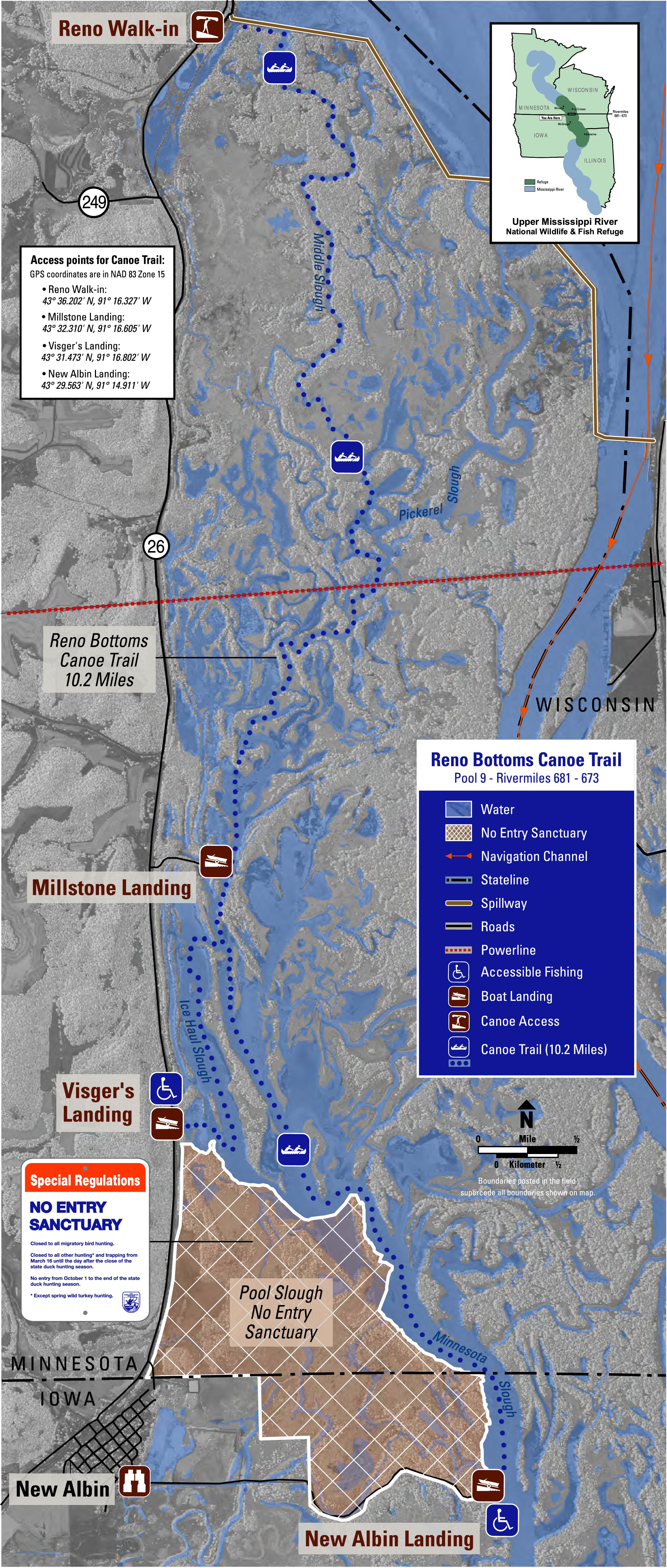
The Friends of Pool Nine have helped create a great venue called Reno Bottoms for those who like to canoe or kayak. Reno Bottoms is about 15 miles North of Lansing on Highway #26. From their website:
“The Friends of Pool 9 were awarded a challenge grant from the U.S. Fish and Wildlife Service to help create a canoe trail in the Reno Bottoms. This area is designated a Research Natural Area due to the diverse floodplain forest habitat that exists there. It is one of the best examples of what the River looked like prior to impoundment.
Working with the Minnesota DNR, we secured permission to place a trailhead at their parking lot on the western edge of the Lock and Dam 8 spillway/dike.
Refuge staff built and installed an offical notice board at the parking lot and put in a nice launch site on the southwest corner of the first spillway on the dike. In order to access this launch you must carry your canoes/kayaks about 100 yards.
For complete information on the trail please click on the Reno Bottoms Canoe Trail Leaflet. We are still working on a detailed map and hope to have that available soon. The trail is well marked with blue/reflective canoe trail signs.
New Trails Coming
If you would like to canoe or kayak from Lansing to Harper’s Ferry, 17 miles to the south, there is a new canoe trail coming for 2014.
The new trail will be family-friendly in that you will be able to see the signs marking the trail from one sign to the other- perfect for canoe trips where you may not be familiar with the river’s curves and bends. A smaller version of the same trail is 9 miles and includes Lansing to Heytman’s Landing.